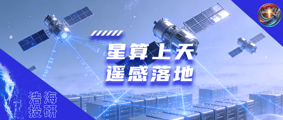
Running Large Models 300 Kilometers Above Earth: Suzhou Keda Makes a Bold Bet on the Trillion-Dollar Remote Sensing Satellite Industry
 01/07 2026
 561
561
Introduction: Deploying AI large models in satellites to enable autonomous 'reading' of Earth.
Did you know that Earth actually 'speaks'? Every leaf, every droplet of water, and every inch of soil silently conveys information through spectra. Hyperspectral remote sensing acts as a super translator, deciphering the language of light.
Historically, this technology was primarily confined to laboratories and research projects. Now, it is rapidly advancing toward farmlands, rivers, cities, and even being launched into orbits 300 kilometers high. Surprisingly, the driving force behind this transformation is not traditional aerospace companies but a video surveillance company—Suzhou Keda (603660).
The company plans to embed AI large models into satellites, enabling them to autonomously 'read' Earth. What may sound like science fiction could soon become a reality.
01 Hyperspectral: From Visualization to Comprehension
Conventional satellites rely on red-green-blue colors for photography, while multispectral systems can distinguish a dozen spectral bands, barely differentiating between water, vegetation, and buildings. Hyperspectral technology, however, captures hundreds of continuous bands simultaneously, spanning visible light to shortwave infrared—equivalent to filming Earth's spectral movie.
This ability to combine imagery and spectra enables it not only to see objects but also to identify their material composition. For example: Which rice paddies lack nitrogen? Where do algal blooms lurk in rivers? Which factories are secretly discharging pollutants? Hyperspectral technology can instantly solve these mysteries. The industry refers to these unique reflection patterns as 'spectral fingerprints.'
Thanks to this fingerprint recognition capability, hyperspectral technology quickly became a valuable tool in environmental protection, agriculture, geology, emergency response, and other fields. The Ministry of Ecology and Environment uses it to detect hidden pollution sources; agricultural authorities rely on it to assess crop water stress, nutrient deficiencies, or pest damage; forest fire prevention systems use it to identify early fire risks. Its strength lies not in broad coverage but in deep insights.
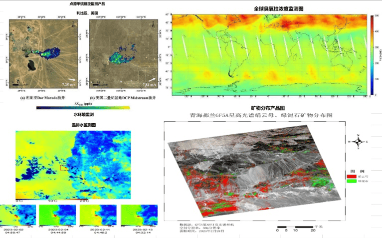
Source: National Space Administration - First Batch of Hyperspectral Comprehensive Observation Satellite Images
National strategy has also made early moves. The 'Medium- and Long-Term Development Plan for Ecological Environment Satellites (2021–2035)' explicitly lists hyperspectral technology as a core payload for environmental monitoring. By May 2025, China had launched over 20 hyperspectral satellites, establishing a preliminary air-space-ground integrated observation network: relying on Gaofen-5 and other main satellites in space, drones for flexible aerial supplementation, and ground spectrometers for calibration.
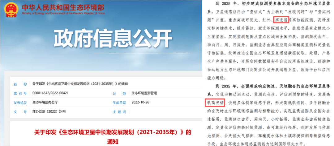
Source: Official Website of the Ministry of Ecology and Environment
With the system taking shape, commercialization has also begun to make breakthroughs. In 2025, Xi'an Zhongke Xiguang completed China's first hyperspectral data asset registration, valued at over 27 million yuan. This means remote sensing data is no longer just a research byproduct but a tradable digital asset with clear ownership rights.
However, new challenges have emerged. Hyperspectral data is enormous—a single satellite can generate terabytes of raw data daily. Limited by downlink bandwidth, transmission to the ground is slow, and processing is even slower. By the time analysis results arrive, the scene has already changed.
Thus, a new idea surfaced: Instead of bringing all data back to Earth, why not let satellites screen it first in orbit?
02 Satellites with AI Brains: Suzhou Keda Pioneers Integrated Satellite Computing
At this critical juncture, Suzhou Keda launched its independent hyperspectral satellite program. If implemented as planned, this will become China's first hyperspectral satellite fully developed and commercially operated by a private enterprise. Its most notable feature is the self-developed integrated satellite computer—the first in China to combine large-capacity storage, AI computing power, and large model inference capabilities on a hyperspectral satellite.
In other words, satellites will no longer be passive cameras but intelligent agents capable of preliminary on-orbit judgment. For example, when detecting abnormal water spectra, the system can automatically flag potential pollution events; in farmland, it can distinguish healthy from stressed vegetation and only transmit key segments. This approach could reduce 90% of inefficient data transmission and compress response times from hours to minutes.
Of course, this technology did not emerge out of thin air. The project leverages a joint lab with a university, collaborating on starborne AI architecture, radiation-resistant chip adaptation, and high-reliability communication links. Industry-university-research cooperation provides solid engineering support.
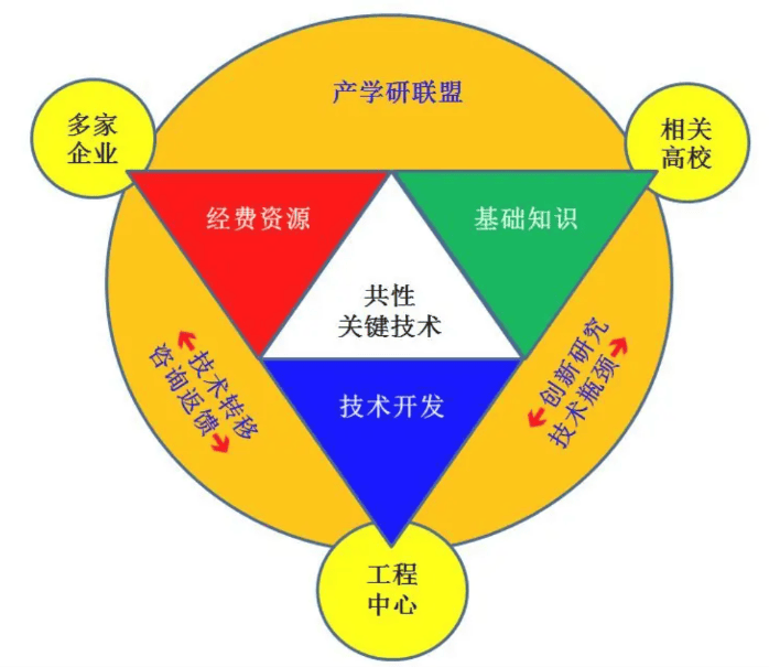
Source: Baidu Baike - Industry-University-Research Collaboration Model
In terms of performance, the satellite's band count could reach industry-leading levels. Once launched, it may become one of the world's highest-resolution hyperspectral satellites, particularly suitable for urban governance, ecological supervision, and other precision-demanding scenarios.
However, onboard intelligence remains a cutting-edge exploration. NASA and ESA are also testing similar solutions, but large-scale commercialization remains immature. Suzhou Keda's attempt is undoubtedly a future-oriented engineering breakthrough. Success would open new horizons; failure would at least pave the way.
03 Air-Space-Ground Synergy: Making Hyperspectral Truly Usable
No matter how advanced, technology cannot sustain itself without buyers. The hyperspectral industry still faces multiple pain points: low data utilization, inaccurate retrieval models, multi-source fusion difficulties, lack of industry standards, and cost sensitivity among users—many local governments prefer cheaper multispectral data over high-precision alternatives.
Suzhou Keda's ambition extends beyond a single satellite. It aims to build an air-space-ground integrated intelligent sensing ecosystem, bridging the gap between 'accurate observation' and 'practical application.'
At the space level, hyperspectral satellites use integrated satellite computers for on-orbit preliminary screening, only transmitting high-value information to significantly reduce ground processing burdens.
At the aerial level, the company has developed its own drone platform with integrated camera modules for high-frequency, flexible local re-imaging in key areas. In case of sudden pollution or fires, drones can arrive within an hour for verification.
At the ground level, mature computing all-in-one machines can be deployed in district/county command centers to rapidly convert satellite or drone data into actionable business instructions.
Source: Suzhou Keda 2025 Interim Report
More importantly, these three layers do not operate in isolation. The company plans unified scheduling across 'satellite-drone-ground nodes' to form a closed loop of unified sensing, processing, and service. For example: Satellite detects river anomalies → automatically dispatches nearby drones → ground nodes generate response recommendations → directly pushes to environmental platforms. Remote sensing thus upgrades from static snapshots to dynamic responses.
This approach aligns closely with Suzhou Keda's core expertise. Over the years, the company has accumulated rich field experience in forest fire prevention, hydrological monitoring, and urban flood warnings. Now, it extends AI computing, scenario understanding, and government-enterprise service capabilities from conference rooms to 300-kilometer orbits and then down to 100-meter low altitudes. What changes is the observation dimension; what remains is the ability to solve real problems.
Of course, making this ecosystem truly operational requires collective efforts. For example: promoting national team-private enterprise collaborations where CAS or aerospace groups provide payloads while companies handle operations and market development; incorporating hyperspectral into smart city baseline standards; establishing pilot projects in national initiatives like Yangtze River protection and black soil monitoring; and popularizing DaaS (Data as a Service) models for on-demand subscription like electricity.
Suzhou Keda's space venture is not about showing off technology but elevating its ground-tested capabilities to higher dimensions. Its bold leap from security to aerospace, though uncertain, offers a new possibility worth serious observation for commercializing remote sensing satellites. (Haohai Investment Research)
-
![]()
Jitian Xingzhou: A Pioneer in Optical Payloads Secures Hundreds of Millions in Series B Funding!
-
![]()
Orders Secured Through to the Second Half of the Year! The Rationale Behind the 'Surge' in Demand for This Company’s Optical-Grade Base Films
-
![]()
Beyond Patents: The Retail Rivalry of Insta360 and DJI Unfolds
-
![]()
180 Billion Market Cap Vanished! How Did Seres Fall So Far?
-
![]()
Blockbuster! Domestic storage takes the global double crown for the first time, from an AI company
-
![]()
China Spearheads Formulation! World's Pioneering Global Technical Regulation for Automated Driving Systems Greenlit and Unveiled
-
![]()
Farewell to Pulsed Support Policies: Three Major Auto Policy Directions from Multiple Departments Take Effect on the Same Day
-
![]()
Embercore AI’s Accelerated Funding: The Robot Industry’s Shift Toward ‘Learning Systems’