Caocao Chuxing Launches 64 Satellites into Orbit! Geely's Space Initiative: Can Autonomous Driving's 'Space Wi-Fi' Outperform Tesla?
 09/26 2025
 715
715
Introduction
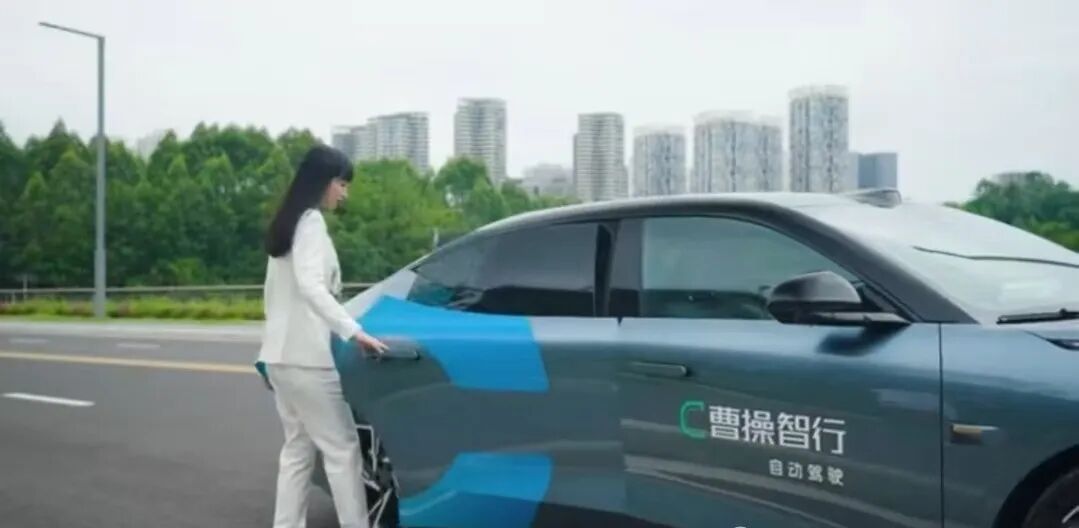
While Tesla drivers grumble about the poor signal reception in underground parking lots, Caocao Chuxing has discreetly outfitted its autonomous vehicles with 'space SIM cards'.
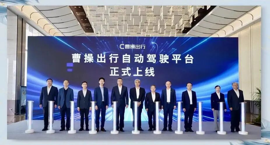
On September 24th, the 64th satellite of the 'Geely Constellation' was successfully launched into orbit, marking the official launch of the world's first satellite network tailored specifically for Robotaxi services.
This achievement means that in the future, Caocao's autonomous vehicles will maintain seamless 5G live-streaming-quality connections with their command centers, even when navigating through the labyrinthine tunnels of Chongqing or the vast expanses of Xinjiang's Gobi Desert.
Even more remarkable, this system enables vehicle positioning with centimeter-level precision—akin to satellites being able to discern if you've strayed across a lane marking.
Let's delve deeper into this topic with Unmanned Vehicle Coming (WeChat Official Account: Unmanned Vehicle Coming)!
I. Satellite Network: The 'Double 11 Insurance' for Autonomous Driving
The 'space insurance' that Caocao Chuxing has secured for its Robotaxi fleet essentially caters to three critical scenarios:
1. Urban Canyon Blindness
Test data from Shanghai's Lujiazui area reveals that due to obstructions from tall buildings, GPS positioning errors can reach up to 30 meters—enough to misidentify a road lane as a sidewalk.
The 'Geely Constellation' system, by integrating low-orbit satellites with ground base stations, reduces this error margin to within 10 centimeters.
In one instance, the system even detected a 3-centimeter deformation in an elevated highway caused by thermal expansion, providing early warnings of potential lane drift risks.
2. Extreme Weather Disconnection Crisis
During the 2023 Zhengzhou floods, an autonomous driving test vehicle lost connectivity for two hours due to a 5G base station power outage, necessitating manual intervention by a safety officer for its return.
Caocao's satellite communication module, equipped with phased-array antennas, maintains a 2Mbps transmission rate even in heavy rain attenuation environments, sufficient for synchronizing data from 10 high-definition sensors.
3. Remote Area Signal Black Holes
A stretch of the Qinghai-Tibet Highway remains devoid of ground signals throughout the year, requiring traditional autonomous vehicles to pre-download high-definition maps.
The satellite network enables dynamic map updates, successfully guiding a vehicle around a newly formed collapse zone caused by a mudslide during this year's tests.
This system adds approximately 3,000 yuan in annual costs per vehicle. However, Caocao Chuxing CEO Gong Xin has calculated that, compared to the compensation and downtime losses from accidents, this investment is akin to 'purchasing lifetime accident insurance for each vehicle'.
II. Geely's Space Initiative: From Car Manufacturing to Building a 'Space Network'
The audacious plan to launch 64 satellites underscores Geely's ambition to transform into a 'space-grade mobility company':
1. Technological Autonomy and Control
Geospatial Information Technology's satellite costs are approximately 45% lower than traditional methods, with production speeds increased by over tenfold, achieving full domestic production of satellite manufacturing, launch, and operation chains.
This means Geely is not beholden to the International Telecommunication Union's spectrum allocation, enabling it to customize communication protocols for Chinese road conditions.
2. Data Hegemony Competition
The high-definition map data collected by satellites nationwide achieves 10-centimeter accuracy and is updated every two hours.
This data not only supports autonomous driving but can also be sold to logistics companies for route planning and even assist in military testing (Geely has obtained Level 2 military qualifications).
3. Ecosystem Closed-Loop Construction
Caocao Chuxing, Geospatial Information Technology, and Zeekr Automobile form a synergistic triad: satellites ensure connectivity, vehicles collect data, and the mobility platform monetizes it.
This model mirrors Tesla's 'vehicle + Starlink' combination, but Geely achieved onboard integration three years earlier.
Notably, the Geely Constellation reserves 2,000 IoT terminal interfaces, potentially opening them to other automakers—provided they adhere to Geely's communication standards and data platform.
III. Harsh Reality: Satellites Are Not a Panacea
Despite the allure of space stories, engineers continue to grapple with these down-to-earth challenges:
1. Latency Issues
Low-orbit satellite signal transmission latency is approximately 20 milliseconds, while vehicle emergency braking demands a response time of no more than 10 milliseconds.
The current solution involves a hybrid satellite-5G routing system: normally utilizing ground networks and automatically switching to satellites during disconnections. However, the 0.5-second lag during switching may lead to misjudgments.
2. Cost Conundrum
The satellite communication module added to each vehicle weighs 3 kilograms, impacting range and increasing energy consumption.
Caocao Zhixing's L4 custom vehicle may sacrifice some luggage space to enhance safety and precision.
3. Regulatory Risks
The 'Radio Management Regulations' stipulate that civilian terminal transmission power must not exceed 2W, while satellite communication requires over 5W.
Currently, Caocao circumvents legal risks through a 'satellite reception + 4G backhaul' approach, but policy changes could pose challenges.
More realistically, Tesla is developing satellite direct-to-phone technology, potentially bypassing automakers to reach consumers directly. If Apple and Huawei follow suit, Geely's billion-dollar 'space highway' may need to adapt.
IV. Don't Treat Satellites as a Marketing Gimmick; They're Just the 'Seatbelt' for Autonomous Vehicles to Achieve Scale
From GPS to Beidou, from 4G to 5G, and now to low-orbit constellations, each leap in positioning and communication technology spawns new business paradigms.
Caocao Chuxing's integration of satellites into Robotaxi is not about showmanship but about offering the industry a 'safety redundancy' standard:
Reducing signal interruptions from 'minute-level' to 'millisecond-level';
Shrinking positioning errors from 'meter-level' to 'centimeter-level';
Upgrading backend supervision from 'ground visibility' to 'global always-online'.
For working-class individuals struggling with driver's license tests, this may offer some solace:
Stop fretting over reverse parking—in a decade, your children might only encounter 'rotating platforms' at amusement parks labeled as 'retro driving experience projects'.
For the industry, the triangular combination of space, AI, and wheels is merely the entry ticket to the autonomous world.
Next, whoever can reduce the cost of the 'space seatbelt' to under 1,000 yuan will be the one to truly bring Robotaxi to every street and alley.
In conclusion, Unmanned Vehicle Coming (WeChat Official Account: Unmanned Vehicle Coming) believes:
Satellites have taken to the skies, autonomous vehicles are landing, and the countdown for driver's licenses has quietly begun.
What do you think, dear reader?
#UnmannedVehicleComing #AutonomousDriving #SelfDriving #UnmannedVehicle #CaocaoChuxing
-
![]()
ByteDance, DJI, and Xiaohongshu Secure Top Three Positions Among China’s Fastest-Growing Unicorns
-
Tesla's in-car voice system in China is finally learning to 'understand human language'
-
![]()
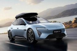
Foreigners Are Amazed: Chinese Electric Vehicle Drive Systems Unveil Innovative 'Poses'
-
![]()
700,000 Brothers and the Future of Robots: Behind JD.com's 'Nirvana Plan'
-
![]()
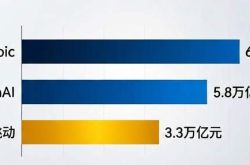
Zhipu's Trillion-Dollar Valuation: A New Chapter for China's AI
-
![]()
Is Laifen, a 'Dyson Alternative' on the Rise, Now Ensnared by the 'Alternative Curse'?
-
![]()
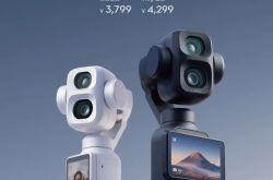
Beyond Patents: Insta360 and DJI Compete in Retail
-
![]()
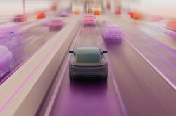
Piercing Through Industry Chaos: The Curtain Rises on Compliance for Autonomous Driving