Is Data Annotation Still Necessary for Occupancy Networks in Autonomous Driving?
 04/17 2026
 403
403
In the realm of autonomous driving, Occupancy Networks (OCC) have emerged as a cutting-edge technology in recent years. As you delve into the world of Occupancy Networks, you might ponder: Given that OCC can perceive the environment through spatial voxelization and even recognize unseen irregular obstacles, is traditional data annotation still required? The truth is, Occupancy Networks have not rendered annotation obsolete; rather, they have elevated the complexity and scope of annotation to unprecedented levels.
Why Have Occupancy Networks Gained Such Prominence?
Early autonomous driving perception systems predominantly relied on object detection logic. This involved labeling objects detected by cameras and drawing 3D bounding boxes to precisely identify pedestrians, vehicles, or trees. Although straightforward, this method encounters challenges when dealing with the vast array of objects in the real world. For instance, if a uniquely shaped cardboard box lands on the road or a water truck tips over, the system might fail to classify them as known objects and thus overlook them, leading to gaps in perception.
Occupancy Networks have revolutionized this logic. Instead of focusing on object identification, they partition 3D space into countless minuscule cubes, known as voxels, to ascertain whether each cube is occupied or vacant. This transition from object recognition to spatial perception empowers autonomous vehicles to navigate around irregular obstacles. As long as a spatial point is occupied, the vehicle treats it as impassable, thereby significantly enhancing driving safety.
However, this technological leap does not imply that the model can learn autonomously. It necessitates extensive data training to accurately assess whether voxels in space are occupied and to determine their physical properties. Consequently, Occupancy Networks still rely heavily on vast datasets, with annotation evolving from 2D or 3D bounding boxes to more precise voxel-level labels.
Does a Voxelized World Still Necessitate Manual Annotation?
To train the model to evaluate the occupancy status of each tiny cube, we must supply a set of standard reference answers during the training process—these are the annotated data. Within the Occupancy Network framework, annotation is no longer confined to simply drawing boxes on images; it now encompasses semantic segmentation of the entire 3D space. This means each voxel must be labeled not only for the presence of an object but also for the object's identity.
The workload associated with such annotation tasks is immense. Relying solely on manual labeling for each voxel in 3D space would be highly inefficient, if not impractical. A single scene may encompass millions of voxels, rendering manual annotation at this level of precision unfeasible. Therefore, Occupancy Network data annotation has adopted a semi-automated approach. However, this does not imply that humans are no longer involved; instead, their role has shifted from frontline annotators to high-level quality inspectors and rule formulators.
The current industry standard involves utilizing high-precision point cloud data collected by LiDAR as a baseline. Algorithms map the point cloud to a 3D voxel grid to generate preliminary occupancy labels. LiDAR inherently provides depth information, informing the system of object locations. Nevertheless, this is insufficient because point clouds lack semantic information. To enable Occupancy Networks to not only detect objects but also discern whether they are roads or vehicles, annotators must infuse semantic information into these voxels through multi-frame fusion and cross-sensor collaboration.
How Is the Data Transition from 2D to 3D Accomplished?
One of the challenges in training Occupancy Networks is that most onboard sensors, particularly cameras, capture 2D images. Aligning 2D pixels with 3D voxel labels lies at the heart of annotation technology. In this process, annotation is no longer confined to individual photos but encompasses a continuous spatiotemporal sequence. Advanced offline algorithms integrate all sensor data collected during vehicle travel to construct a comprehensive 3D world model.
In this pre-built 4D spatiotemporal model (3D space plus time), object trajectories and shape changes are meticulously recorded. The system utilizes this offline high-precision information to refine online perception models. In essence, we employ the most sophisticated equipment and the slowest computation in the lab to generate a nearly flawless standard answer. Subsequently, we require the vehicle's perception algorithm to achieve a high score, approaching this standard answer, using only camera input.
This annotation method demands exceptional data consistency. If spatiotemporal drift occurs during annotation or if there are calibration biases (deviations) between different sensors, the model may produce erroneous results. Therefore, the Occupancy Network annotation pipeline incorporates extensive automated processing for sensor extrinsic calibration and multi-frame temporal alignment. Nevertheless, complex occlusion relationships, noise from rain or snow, and long-tail scenarios still necessitate experienced annotators for meticulous corrections and confirmations.
Is Automated Annotation the Ultimate Objective?
With the advancement of large models and self-supervised learning technologies, Occupancy Network annotation is evolving towards minimizing manual dependency. For instance, by predicting the next frame in a video or leveraging the continuity of object motion, models can achieve a degree of self-learning and rectify their perception through projection error calculations. This self-supervised approach can partially reduce reliance on costly annotated data but cannot yet fully supplant high-quality manual ground truth.
Especially in scenarios involving traffic regulations and specialized semantic understanding, machines still struggle to capture subtle yet critical information. For example, a plastic bag blown by the wind and a hard rock may both appear as occupied voxels to an early Occupancy Network, but their handling logic differs significantly for driving decisions. This necessitates manual annotation to provide deeper semantic guidance, elevating mere physical occupancy to logically judged semantic perception.
Final Reflections
The widespread adoption of Occupancy Networks has not eliminated the annotation industry; instead, it has propelled its evolution. Annotation companies now require enhanced 3D reconstruction capabilities, more sophisticated algorithmic toolchains, and a profound understanding of long-tail scenarios in autonomous driving. The future does not lie in eradicating annotation but in rendering it more intelligent and imperceptible. By constructing a closed-loop data system capable of automatic generation, validation, and evolution, Occupancy Networks can truly unlock their potential to perceive everything.
-- END --
-
How Meituan is Becoming the 'Interface' for AI Integration into the Physical World
-
![]()
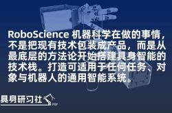
RoboScience Machine Science Makes ICRA Best Paper List for Two Years Running with Its 'Embodied Brain' Innovation
-
![]()
Focusing on UTG Ultra-Thin Flexible Glass! CSG Optical New Material Production Base Establishes in Xianning, Hubei
-
![]()
AI Meets Optics: Tsinghua Smart Vision Secures A+ Round Funding Led by Hillhouse Capital
-
![]()
Why are 3C Brands Flocking to Douyin Mall During 618?
-
![]()
Token Economy Falters as Economic Tokenization Faces Challenges
-
![]()
Lenovo's Monthly Surge of 109%, Foxconn Industrial Internet's Market Cap Surpasses Kweichow Moutai: A Collective Resurgence of the 'IT Old Guard'?
-
![]()
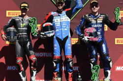
After Zhang Xue's Victory, Where is Motorcycle Intelligence Headed?