There Are Already Tens of Thousands of Satellites in the Sky—Who Will Stop Them from Colliding?
 11/10 2026
 473
Exactly how many satellites are there above Earth?
Statistics updated by the European Space Agency on November 2 show that about 15,800 satellites are still in operation. This number will continue to grow. S&P Global estimated in September that, if deployment plans proceed smoothly, eight major low-orbit operators with U.S. regulatory approval alone could deploy about 51,700 satellites in the coming years.
China is also accelerating constellation construction. On November 3, 18 more Qianfan satellites entered orbit, bringing the total to 274, with a long-term plan exceeding 15,000. Large constellations such as China SatNet are also under continuous construction.
As new satellites are launched batch after batch, how should orbits be arranged? And how can those already flying in space avoid collisions?
On November 7, Geovis launched "Xingyan-01." This satellite, operating at an altitude of about 500 kilometers, has as its main mission monitoring other spacecraft and space debris. The company's planned "Xingyan" constellation has a total of 156 satellites, and the first satellite will verify the coordinated capability of space-based observation and ground-based analysis.
01 How Satellites Find Their Orbits
Before launching a satellite, operators must first decide where it will operate.
Low Earth orbit generally refers to space 200 to 2,000 kilometers above the ground. A satellite's operating altitude and inclination must meet its assigned mission. After a new satellite enters orbit, it may sometimes need to continue raising its orbit, passing through altitude bands where other satellites operate, before reaching its planned orbit.
Orbits do not have fixed slots like parking spaces on the ground. Satellites fly around Earth at 7 to 8 kilometers per second. Even at similar altitudes, they may travel along different orbital planes and periodically pass through the intersection regions of one another's trajectories. Whether they collide depends on whether they arrive at the same position at the same time.
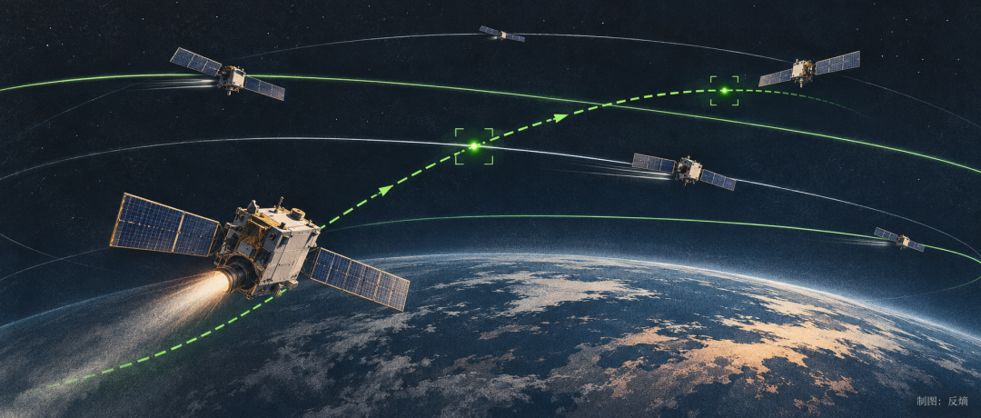
Orbital intersections do not in themselves mean collisions will occur, but as the number of satellites in orbit grows, more and more close approaches need to be predicted. An operator must not only know the positions of its own satellites, but also continuously track other spacecraft that may enter its operating region.
For constellations with thousands of satellites, maintaining safe operations is a task that runs throughout the entire life cycle. Even after a satellite has entered its planned orbit, it may still need to adjust its trajectory based on collision warnings.
Working satellites can still actively avoid risks, but objects that have long been defunct yet continue speeding through space have become a more difficult threat to handle.
02 Where Do Retired Satellites Go?
In February 2009, the still-operational U.S. Iridium 33 and Russia's long-defunct Kosmos 2251 collided at an altitude of about 790 kilometers. The relative speed of the two satellites reached 11.6 kilometers per second, and the impact produced more than 1,800 trackable fragments about 10 centimeters or larger.
A retired satellite can still destroy another satellite that is providing services. And the debris left by the collision will continue to threaten more later arrivals.
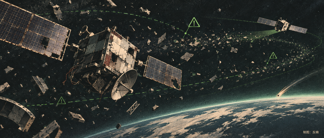
After a satellite's life ends, it does not automatically leave space. Many modern low-orbit satellites actively lower their orbits before retirement and then rely on atmospheric drag to re-enter Earth, with most of their structures ablating during re-entry. However, satellites that have lost contact cannot execute deorbit commands, and many spacecraft launched in earlier years lack the necessary end-of-life disposal capability.
Orbital altitude directly affects how long debris remains. The higher the altitude, the thinner the atmosphere and generally the lower the drag. NASA notes that debris below 600 kilometers can usually re-enter within a few years; near 800 kilometers, natural decay time may reach decades or even longer.
The European Space Agency has shortened the post-retirement disposal deadline for its new missions in protected low-orbit regions from 25 years to 5 years. But this new rule cannot clear the defunct spacecraft left over decades, and it is even harder to deal with the large amount of debris produced by collisions and explosions.
The European Space Agency estimates that about 1.5 million pieces of space debris 1 to 10 centimeters in size are currently orbiting Earth. Low orbit is the region where debris risk is concentrated, with large amounts of historical wreckage distributed at altitudes of 600 to 1,100 kilometers. Debris only a few centimeters in size is difficult to track continuously, yet at relative impact speeds of several kilometers per second or even higher, it is enough to severely damage a satellite.
In the 1970s, scientist Donald Kessler and others proposed that once debris in certain orbits accumulates densely enough, new debris from collisions would trigger more collisions, forming a continuously growing cloud of wreckage. Even if new satellite launches stopped, some orbital environments could continue to deteriorate.
Later, this mechanism became known as the Kessler effect.
Satellite end-of-life disposal can reduce new debris, but it cannot eliminate all historical risks. For satellites still in operation, more direct protection lies in detecting danger as early as possible and avoiding it in advance.
03 Sending Eyes into Space
How can we know whether a piece of debris hundreds of kilometers away will hit a certain satellite in the future?
Traditional space monitoring mainly relies on ground-based radar and optical telescopes. Equipment records the positions of targets at different times, and ground systems calculate orbits accordingly and then predict possible future close approaches.
The difficulty of this approach lies in continuous updating. Optical observation is limited by weather and lighting, and radar is also constrained by coverage and observation frequency. Solar activity changes upper-atmosphere density and affects the drag experienced by low-orbit targets; if a satellite makes a temporary maneuver without timely notification, other operators' orbital information may lag behind its actual position.
Even if it is predicted that two satellites will pass very close to each other, orbital measurement errors must be incorporated to calculate collision probability before deciding whether to take evasive action. The more accurate the observation data and the more timely the updates, the greater the operator's opportunity to reduce unnecessary maneuvers.
"Xingyan-01" attempts to send some observation equipment directly into space. It carries a wide-area optical surveillance camera and an onboard computing unit, using sunlight reflected by space targets for observation. By measuring multiple times the changes in a target's position relative to the observation satellite and then combining that with ground-platform orbit calculations, it completes target cataloging and risk analysis.
Space-based observation can increase observation opportunities for some targets and improve the coverage limitations of ground-based monitoring. However, optical sensors are also affected by lighting conditions and target size. The first satellite currently mainly undertakes in-orbit verification, and the planned continuous monitoring capability still awaits subsequent constellation networking.
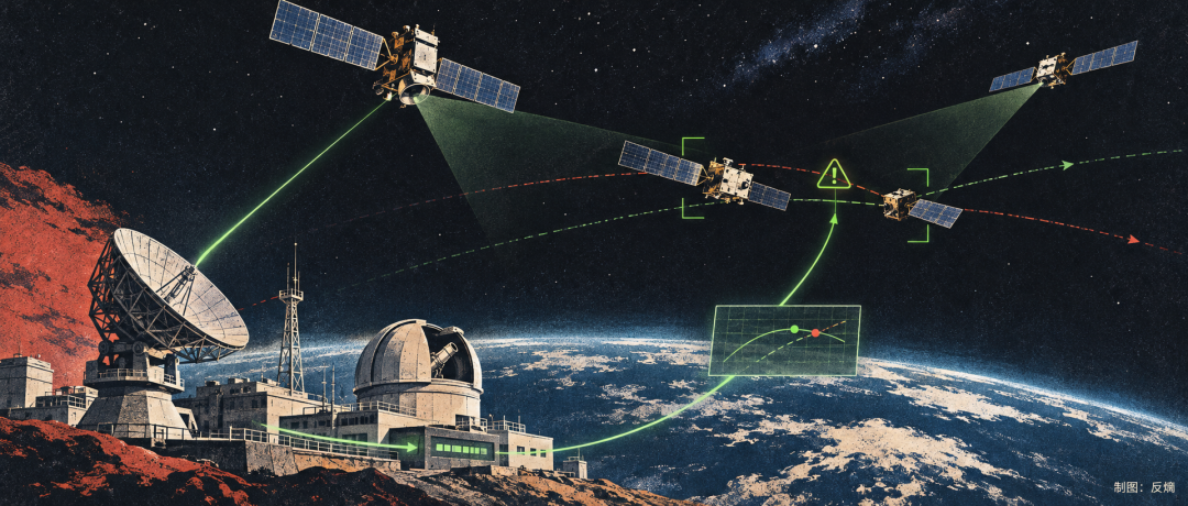
This year SpaceX announced another approach. Its Stargaze system uses the approximately 30,000 star trackers already on Starlink satellites to observe surrounding objects, recording about 30 million events per day of targets passing through the field of view and updating orbital information accordingly. Star trackers were originally used to determine satellite attitude, and now they also take on part of the space monitoring task.
SpaceX uses its existing communications constellation to expand observation capability, while Geovis plans to build an independent sensing constellation. The two approaches differ in construction cost and coverage, and future competitiveness will also depend on actual observation quality and service efficiency.
For China, independent monitoring also has more direct practical significance. Qianfan and SatNet are continuously deploying low-orbit satellites, and the orbital environment has no national borders. As the scale of China's in-orbit assets expands, whether it can continuously obtain accurate and credible orbital data will directly affect the operational efficiency of its constellations.
04 Who Pays for Space Safety?
Information submitted by SpaceX to the U.S. Federal Communications Commission shows that from December 2025 to May 2026, Starlink satellites carried out about 207,000 propulsive collision-avoidance maneuvers.
This figure represents the frequency of collision-avoidance maneuvers, not more than 200,000 collision emergencies. SpaceX adopts a relatively conservative risk threshold, and a single close approach may correspond to multiple maneuvers.
Frequent collision avoidance has become an operational burden that large constellations must bear. Each propulsive maneuver may consume fuel, and changing orbits may also affect assigned missions. For a network composed of thousands of satellites, improving warning accuracy and reducing unnecessary orbital changes have real economic value.
A professional services market has thus emerged.
U.S.-based LeoLabs already uses a ground-based radar network to provide customers with orbital monitoring and collision warning services, while the TraCSS system built by the U.S. Department of Commerce provides free basic space safety services. SpaceX also offers some free screening services to operators participating in its platform.
The existence of free services means that commercial monitoring cannot rely solely on selling basic warnings for revenue. Higher-precision observation, more timely orbital updates, and automated collision-avoidance support for large constellations may create differentiated commercial value. Whether Geovis can build a sustainable business on 156 satellites still needs to be verified by actual networking capability, construction costs, and customer demand.
But there is another part of orbital safety that cannot be solved by commercial services alone.
Monitoring companies can report that two satellites may collide, but they have no authority to require either party to change orbit. If one satellite is already defunct, avoidance can only rely on the party that still has maneuver capability; even if both parties can adjust their orbits, they also need to exchange forecasts and maneuver plans in a timely manner to avoid creating new risks through their separate actions.
The deeper contradiction comes from the shared use of orbital resources.
An operator expands its business by launching more satellites, but the debris produced by collisions may remain in orbit for decades, posing a long-term threat to other countries and companies. Commercial benefits accrue to the operator, while environmental risks are borne jointly by more participants. This is precisely the externality of public resources discussed in economics.
On October 23, China released "China's Position on Strengthening Outer Space Governance," proposing to strengthen information notifications such as collision risk warnings and space object re-entry, and to promote international coordination in the fields of space traffic and debris mitigation. As large low-orbit constellations accelerate deployment, independent monitoring capability, cross-operator data sharing, and collision-avoidance rules will all become important conditions for maintaining orbital safety.
Commercial spaceflight is lowering the threshold for satellite manufacturing and launch, but maintaining the orbital environment requires long-term investment. A company can calculate its own satellite operating costs, but the damage caused by a collision to the entire orbital environment is difficult for the market to apportion on its own.
As the number of satellites moves from tens of thousands toward hundreds of thousands, what the space industry needs to consider will also include how to maintain the shared orbital environment and who should bear the corresponding responsibilities and costs.
-
![]()
Real Vehicles Take Center Stage at CIIE — and Finally, a Way Out of Involution
-
![]()
Musk Suddenly Exposes Masayoshi Son's Shocking Secret — SoftBank Stock Plunges 10%
-
The Viral "Big Fat Fish" Reminds Me of the Liveliest Era of the Internet
-
![]()
Lei Jun Takes Personal Charge as Xiaomi Establishes New Department to Storm Porsche's Home Turf
-
![]()
February Rakes In 12 Billion Views! A 54-Year-Old Uncle from Henan Teaches Himself AI and Creates the Hit Short Drama "Armed Into Song"
-
![]()
15 Years, 10 Leaders: Beijing Hyundai Couldn't Hold On to Its First Chinese General Manager
-
![]()
There Are Already Tens of Thousands of Satellites in the Sky—Who Will Stop Them from Colliding?
-
![]()
BMW 330 Bare Car Price Drops to 210,000 Yuan, Volvo EM90 Cut in Half! Car Dealers: Prices Will Fall Another 20% by Year-End