How does autonomous driving ensure perception accuracy on bumpy roads?
 02/25 2026
 455
455
When autonomous vehicles travel on urban roads, country lanes, or gravel surfaces, the stability of the perception system faces unprecedented challenges. These challenges arise not only from changes in ambient lighting or an increase in obstacle types but also from the physical vibrations and severe attitude fluctuations generated when the vehicle interacts with the road surface.
Vibrations from bumpy roads directly affect the precisely mounted sensor hardware, causing physical distortions, blurring, or even signal interruptions in the raw data collected by the sensors.
If the perception system cannot effectively address these dynamic interferences, the vehicle may misinterpret road undulations as obstacles or lose stable tracking of pedestrians ahead during severe shaking. So, how does autonomous driving ensure perception accuracy on bumpy roads?
Sensor Mounting Architecture and Mechanical Shock Absorption Technology
Before enhancing algorithms, the first step is to minimize the direct impact of vibrations on sensors at the physical level. Autonomous vehicles typically deploy a large amount of perception hardware, including LiDAR, high-definition cameras, and millimeter-wave radar, on the roof, side wings, and front bumper. When driving at high speeds over uneven surfaces or speed bumps, the vehicle body generates complex mechanical vibrations.
Research on the perception reliability of autonomous vehicles shows that cameras mounted on standard vehicle structures typically experience acceleration forces between 3.5g and 14g under normal driving conditions, with vibration frequencies covering a range of 10 Hz to 2500 Hz.
Without effective isolation, these vibrations can severely degrade image quality. Analysis using the Modulation Transfer Function (MTF) reveals that vibrations at specific frequencies exceeding 0.75g can reduce image sharpness by over 50%.
To withstand such physical impacts, the design of sensor brackets must adopt a force-balancing strategy.
Hardware engineers introduce high-performance elastic isolators to absorb high-frequency vibrations. These isolators, typically made of elastic materials with specific Shore hardness (e.g., 25A to 65A), can effectively attenuate high-frequency jitter (jitter) above 180 Hz, achieving shock absorption efficiency of 85% to 97%.
For low-frequency, large-amplitude fluctuations caused by rapid vehicle undulations, hydraulic or pneumatic damping systems are required to reduce the amplitude of low-frequency oscillations (4 Hz to 35 Hz) by more than 78%.
Additionally, the choice of bracket material itself is highly critical. Since autonomous driving systems demand extremely high extrinsic parameter stability, even minor physical deformations can lead to perception errors. For example, at a distance of 50 meters, a mere 1-degree installation angle deflection can result in a detection error of approximately 87 centimeters, posing safety risks in narrow lanes.
Therefore, high-specification perception platforms tend to use composite materials with low thermal expansion coefficients and high rigidity to ensure that sensor displacement remains within an extremely small range of 0.035 millimeters, even under severe environmental temperature fluctuations ranging from -40 degrees Celsius to 85 degrees Celsius.
In addition to passive shock absorption, active stabilization technologies are also employed in perception systems. Some autonomous driving platforms borrow anti-shake principles from professional photography equipment, utilizing microelectromechanical systems (MEMS)-driven active stabilization mechanisms to compensate for minor camera tilts in real-time within milliseconds.
This technology can extend the correction bandwidth to 920 Hz, maintaining image horizon stability even under extreme bumping conditions.
Software-Level Processing for Bumpy Roads
Even when physical shock absorption technologies meet requirements, the vehicle's real-time motion during travel can still introduce "distortion" issues in sensor data. This is particularly evident in mechanically rotating LiDAR systems. LiDAR constructs a 3D model of the surrounding environment (i.e., a point cloud) by emitting laser beams and receiving reflected echoes.
A full 360-degree scan by LiDAR typically takes 50 to 100 milliseconds. On bumpy roads, the vehicle may experience severe pitching or rolling during this scanning cycle.
Since LiDAR assumes all points originate from the same point, the collected point cloud will exhibit noticeable "stretching" or "distortion" without compensation. For example, utility poles along the roadside may appear tilted, or a flat road surface may look uneven in the data.
To address this issue, autonomous driving systems introduce "de-distortion" algorithms assisted by Inertial Measurement Units (IMUs).
The technical logic of this process involves using the IMU to record the vehicle's angular velocity and acceleration in three-dimensional space at an extremely high sampling rate (typically greater than 200 Hz). Through motion differential calculations, the precise position and attitude (i.e., PVA state: position, velocity, and attitude) of the LiDAR at the moment each laser beam is emitted are derived.
The perception system projects each laser point collected during the scanning cycle back into a unified reference time coordinate system based on its instantaneous displacement at the time of collection. This motion compensation not only restores the true geometric shapes of objects but also significantly improves the accuracy of subsequent object recognition models in segmentation and classification.
For cameras, the issue caused by bumping is motion blur. When severe shaking occurs while the shutter is open, light crosses multiple pixel sensing units, causing image edges to become blurred.
To address this problem, a strategy combining hardware control and software restoration can be adopted.
At the control level, the system monitors IMU vibration intensity in real-time. When vibrations exceed a preset threshold, the camera's exposure strategy is automatically adjusted to "freeze" the momentary scene by shortening the exposure time and simultaneously increasing the ISO gain to maintain image brightness.
Although high ISO introduces some noise, it interferes less with deep learning algorithms compared to irrecoverable motion blur and can be optimized through subsequent AI denoising models.
Millimeter-wave radar, as the only sensor in autonomous driving with all-weather speed measurement capabilities, also performs suboptimally on bumpy roads. It primarily relies on emitting Frequency-Modulated Continuous Wave (FMCW) and analyzing phase changes in reflected waves to determine target speed.
However, the vehicle's mechanical vibrations directly alter the physical distance between the radar antenna and the target object. These minor displacements are superimposed on the radar's echo signal, causing irregular phase shifts.
In the field of signal processing, this phenomenon is known as phase noise, which causes the target's energy to spread in the Doppler frequency domain, resulting in so-called Doppler broadening.
This energy dispersion has two direct negative consequences: first, the intensity of the target's true signal is reduced, potentially causing the sensor to miss clearly visible targets (detection probability PD decreases); second, it generates significant "sidelobe" interference in the frequency domain, misleading the algorithm into perceiving numerous false dynamic objects around it, leading to frequent false triggers or false braking.
To address this hardware limitation, radar signal processing algorithms can employ "dynamic phase cancellation" technology. The basic principle is that while detecting dynamic targets, the radar system simultaneously scans a large number of stationary reference objects in the environment, such as roadside guardrails, traffic signs, or parked vehicles.
Since these objects are physically stationary, any frequency fluctuations in their echo signals can be regarded as projections of the vehicle's own vibrations.
By analyzing the echoes from these stationary objects, the algorithm can retroactively estimate the radar antenna's current instantaneous vibration phase and apply it as a compensation factor to all detected signal points in real-time.
This process successfully refocuses the radar's detection, restoring the signal-to-noise ratio (SNR) and ensuring that the vehicle's speed judgment of obstacles ahead remains accurate to the centimeter-per-second level, even on highly bumpy roads.
This software-defined radar enhancement technology significantly mitigates perception quality degradation caused by mechanical instability or poor road conditions.
Multimodal Perception and Occupancy Grid Networks
Any single sensor has limitations in extreme bumping environments. True perception robustness relies on multi-sensor data fusion (MSF). In severely bumpy scenarios, the perception system automatically enters a "dynamic trust management" mode.
Different types of sensors have varying sensitivities to vibrations. Cameras are most sensitive to optical axis misalignment and motion blur, LiDAR is sensitive to local point cloud density variations, and millimeter-wave radar is sensitive to phase interference.
Through Kalman Filtering or probabilistic frameworks based on variational inference, the perception system can evaluate the data quality of each sensor in real-time and dynamically adjust their weights in the final decision-making process.
When the system detects severe motion blur in the camera due to intense bumping, the fusion model automatically reduces the confidence level of visual classification results and shifts more decision-making reliance toward the spatial geometric features provided by LiDAR and the velocity vectors from millimeter-wave radar.
This redundancy mechanism ensures that the system as a whole maintains a basic understanding of the environment, even if one sensor temporarily fails.
To further enhance perception accuracy on unstructured roads, technology is widely shifting toward "Bird's Eye View" (BEV)-based representation learning and Occupancy Grid Networks.
Unlike traditional object recognition tasks (i.e., first identifying what an object is and then determining its location), occupancy grid networks divide the space around the vehicle into countless small three-dimensional cubes.
The system uses deep neural networks to predict, in real-time, the probability of each cube being "occupied" by an object, synthesizing video streams from multiple cameras and LiDAR point clouds.
The advantage of this method is that it does not rely on specific object models. On bumpy roads, mud, gravel, or even undescribed road collapses may be splashed up. Traditional classifiers struggle to accurately determine the categories of these irregular objects, but occupancy grid networks can directly perceive that forward space is obstructed, guiding the planning system to make evasive maneuvers.
Additionally, since BEV space represents a unified geographic coordinate system, the system can remember perception information from past frames using time-series models (e.g., recurrent neural networks or Transformers). If the current frame experiences instantaneous perception data gaps due to vibrations, the system can infer the likely positions of obstacles from historical frames, maintaining perception continuity.
Perception Preview Control and Active Chassis Systems
The goal of the perception system is not simply to "cope with vibrations" but to collaborate deeply with the chassis system to actively "eliminate vibrations." This technology is known as Suspension Preview Control. Within this framework, the perception system serves not only the planning system but also acts as a "forecaster" for the chassis.
The vehicle's forward visual perception module (typically binocular cameras or LiDAR) scans the road contour 5 to 15 meters ahead in real-time, accurately measuring the depth of each pothole or the height of speed bumps.
The terrain data captured by the perception system is transmitted to the electronic chassis control unit within milliseconds. Taking NIO ET9's SkyRide chassis or ClearMotion's active suspension system as examples, when the perception system predicts that the front left wheel is about to pass over a 5 cm deep pothole, the suspension system pre-adjusts the damping at that wheel position and actively generates a downward thrust to keep the vehicle body level and stable as the wheel descends.
This "preview-feedback" closed-loop system significantly optimizes the working environment of perception sensors. The more stable the vehicle body, the closer the images and point clouds collected by the sensors are to ideal conditions, which in turn improves perception accuracy.
This deep integration of perception and chassis transforms the autonomous vehicle from a mere mechanically moving object into an intelligent entity with predictive capabilities. The system can utilize cloud-based road maps, combined with the vehicle's real-time perception, to construct a "terrain database" covering the entire city.
Through this collective intelligence, the first vehicle to traverse a damaged road surface shares the perceived bumping parameters with following vehicles, enabling them to preemptively reinforce perception accuracy and prepare their suspensions when approaching the area.
Final Thoughts
Ensuring perception accuracy on bumpy roads represents a concentrated demonstration of the engineering capabilities of autonomous driving systems. It requires vehicles to possess mechanical durability under extreme conditions in hardware design, a profound understanding of physical motion laws in underlying algorithms, and fusion intelligence capable of handling highly uncertain data at the top-level architecture.
With the proliferation of solid-state LiDAR, the evolution of end-to-end model perception capabilities, and the decentralization of active chassis technologies, future autonomous driving perception systems will exhibit visual adaptability closer to or even surpassing that of humans, enabling intelligent driving to navigate various road conditions with ease.
-- END --
-
![]()
Smartphone Prices Surge Amid Manufacturer Anxiety
-
![]()
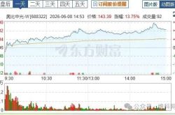
Orbbec Soars to Record Heights, Eyes Further Capital Influx of 980 Million!
-
![]()
Tongding Interconnect Sets Up Shop in Shaoguan with 800 Million Yuan in Registered Capital
-
![]()
Before Kimi’s A-Share Debut, Zhipu Aims to Secure More 'Strategic Funding'
-
![]()
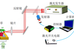
Innovative Leap | Fiber-Pluggable 1470nm Laser Source: Revolutionizing Precision Laser Weeding
-
![]()
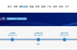
73-Day Rapid Listing: Where Does Unitree's Wang Xingxing's 'Sense of Urgency' Come From?
-
![]()
AI Project Mindverse, Backed by Meituan, Faces Data Inflation Allegations Over Its Macaron Product
-
![]()
3000-word In-Depth Analysis | What Makes Physical AI So Magnetic? It Has Captivated Masayoshi Son, Jensen Huang, and Justin Sun All at Once